Mariner Warning! Do What I Now Say, Not What I did!
Back in 1998, I bought a custom-built, 40 ft Ed Monk Trawler. This was my wonderful boat, Rainbow.
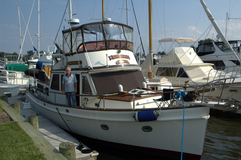
This was a full-displacement vessel, with twin Lehman diesel engines, so it was very efficient. Most powerboats plane, and that requires a huge expenditure of fuel, but they are very fast. My trawler had a diesel generator so that we could have power whenever we were anchored and underway. When at a marina, we used its power. The trawler could do 1,100 miles on the 300 gallons of diesel fuel in the tanks, but the maximum speed was about 9 mph (the hull speed was about 8 knots). So we moved slowly.
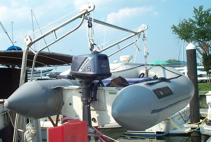
We had a 10 ft dinghy hanging from stainless steel davits off the stern. At anchor, we could lower the dinghy and use its small 5 hp engine to take us to shore.
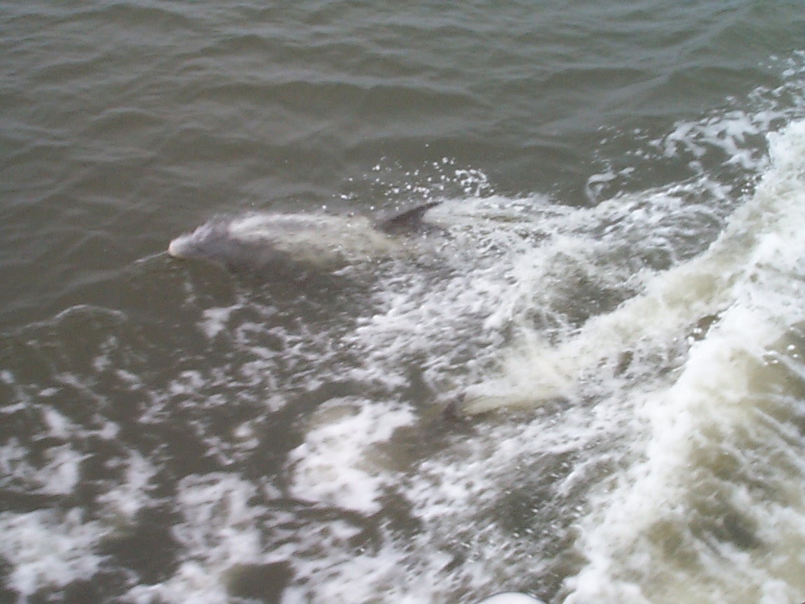
Over the next couple of years, we made the 1,200 mile voyage down the Intracoastal Waterway from our marina in Solomons, MD, to Miami, or to the St. Lucie river and canal and locks, and across it to Lake Okeechobee, and then through the Caloosahatchee canal and locks to Ft. Myers. In the latter trips, we would cruise from Marco Island through the gulf to Key West, and return home from there. At 8 knots, it took weeks and months to make such trips. One of the joys we encountered as we entered warmer waters of the Carolinas was the presence of dolphins swimming off our bow wave, or the wake.
We kept logs of our daily trips and sent those logs by email to our family and friends. I had a computer in the forward berth that could be connected to the Internet when we were at a marina. We also had a Single Side Band receiver, from which we could get long-distance signals of weather maps, so we could try to avoid bad weather. The trawler had radar, two VHF radios, and a Rolls Royce quality GPS system with the latest ICW charts. (There were no charts for the Bahamas.)
On our last trip, we left Solomons in early November of 2000 and cruised down to Noname Harbor on Key Biscayne. Then we crossed the gulf stream to Bimini, and from there to the string of keys of the Bahamas, all the way down to George Town. We were at sea for more than 6 months. We even rented our house and took our cats.
Upon return to Solomons on our last trip, we had a problem. Here is the log for that day:
Trawler Rainbow Log, April 7, 2001
"On April 7th (2001) we were at the Atlantic Yacht Basin in Chesapeake, VA, about 120 miles from our home port in Solomons, MD. We planned to leave Chesapeake the next morning and make that final leg in two days. Since the trawler cruises at about 8-10 knots, that would be about 7 or 8 hours of travel each day.
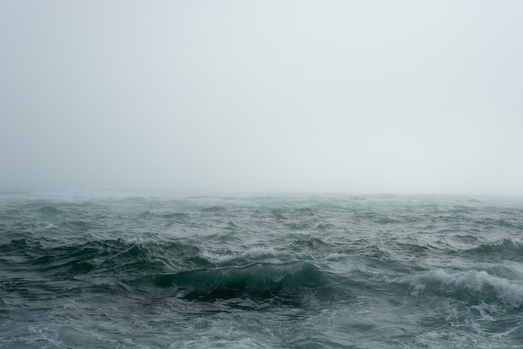
On April 8th, we left Chesapeake City at 6:45 a.m. When we reached the mouth of the Rappahannock River, where we were to have gone into port for the night, it was only 2 p.m., and I was most anxious to complete the journey. Thus, I made the decision to go all the way that day. We were in a following seas situation, with winds out of the SW at about 25 knots, with waves of 3 to 4 feet. It meant that I had to constantly correct for motions induced by those following seas, and that the autopilot could not be used.
By 4:30 p.m., I was exhausted, and we were still some 25 miles from our home port. The skies were clear, but out of the NW I could see some clouds forming. We had passed the mouth of the Potomac River. There began some ominous and repeated announcements from Coast Guard Baltimore Station on Channel 16. They were warning of extremely severe weather, including gale force winds of 50 to 60 knots, 20 foot waves, and heavy rain and thunderstorms on the Bay and its tributaries. I hoped we would be able to get to port before it would hit us, but we simply had no other options at this point.
At about 5:45 p.m., the SW wind stopped, and the water was somewhat calm. But up ahead, I could see the water "dancing." In less than 5 minutes, the wind had shifted to the NW, became extremely strong, and waves began to build. Within a half hour, the temperature had dropped from about 75 degrees to about 50 degrees, and we were plowing through 20 foot waves, in a rain driven by winds of at least 50 knots, and gusting.
We simply could do nothing but hold our course into the wind, and try to get to the Patuxent River. My wife, Alice, happened to be with me on the fly bridge, and she held onto rails with both hands, and I held onto the wheel. When the bow plowed into the waves, huge volumes of water came up and over and into the bridge, some 17 feet from the water line. Alice and I were soaked, as were our electronics.
At one point she asked, "Are we going to make it?" I responded, "I think so."
The VHF radio was shorted out by the salt water (my new one is now waterproof), and we could not, under these conditions, go below to use the other VHF radio. Our radar also failed. The GPS (Northstar 951) continued to work properly, and we could see our position and markers on the moving chart. Since we could see nothing outside, we navigated from the GPS.
We had an EPERB, but I did not think we were quite yet in such a dangerous situation to use it. The pounding and drenching continued for about two hours, after which we finally were able to get off the Bay and into the Patuxent river, and to our marina (Blackstone). When we arrived at about 7:35 p.m., we were fortunate that Lester Gould, the marina owner, was there to help us tie up. Only then did we realize the extent of damage we had suffered.
Two reinforced stainless steel davits had held our dingy off the stern. One davit was gone, and the other bent to the water line and was dragging the dingy. When we went below, we found that both sliding doors had opened, and seawater had entered the cabins. My laptop computer was drenched and ruined, as were a TV and several other electronic items. Our two cats had hidden in a cabin under bedclothes and were OK. And we were wet, cold, but alive, so considered ourselves lucky.
The next morning, April 8, 2001, it was snowing. It is ironic that in cruising some 2,400 miles, we should experience our only severe storm when we were less than 15 miles from our home port.
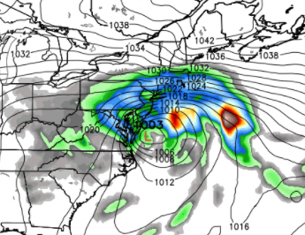
When I subsequently examined the weather isobars for April 7, having retrieved weather data for the area on the Bay where we were, the isobars were so close together that they appeared inseparable, and I found that the wind speeds had reached 69 knots. This is what the isobars looked like. The closer the spacing, the stronger the wind.
p.s. We bought new electronics, and I found an Amish machine shop that made new stainless steel davits.
Bill G. Aldridge